 South Carolina : Safety by City
- Aiken
- Beaufort
- Charleston
- Clemson
- Columbia
- Folly Beach
- Fort Mill
- Gaffney
- Greenville
- Hilton Head Island
- Isle of Palms
- Manning
- Mauldin
- Mount Pleasant
- Myrtle Beach
- North Augusta
- Orangeburg
- Pawleys Island
- Rock Hill
- Spartanburg
- St. Helena Island
- Sullivan’s Island
- Summerville
- Travelers Rest
- Walterboro
- West Columbia
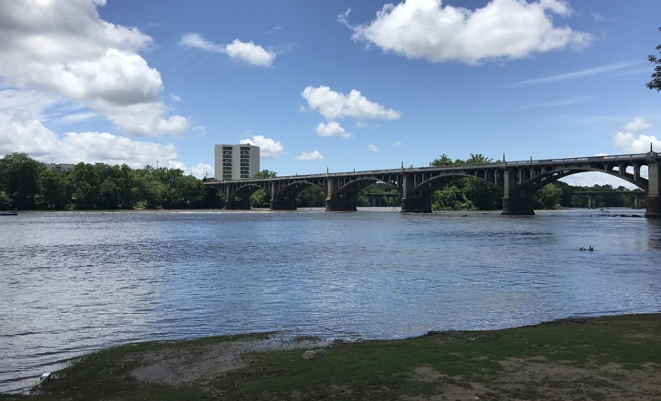
West Columbia, South Carolina, sits across the river from the larger Columbia in the Midlands region of the state.
The city has a population of just more than 17,000, which is quite common in South Carolina to have smaller towns with a big appeal.
Sure, being close to the state capital helps, but West Columbia has built a name for itself on this side of the Congaree River.
West Columbia has plenty of Southern charm, art, and history wrapped up in one of the most adventurous riverfronts in the state.
The bonus of Congaree National Park nearby also brings in tourists to explore that unique ecosystem.
Nearby Lake Murray offers even more water-based activities, which means staying in West Columbia gets you that much closer to the fun.
If you want to visit the beach, it’s just an easy two-hour drive on the interstate to Charleston.
For those who remember the plane crash involving Blink 182’s Travis Barker and DJ AM, it was from the airport in West Columbia where that plane lost control on the runway.
Warnings & Dangers in West Columbia

OVERALL RISK: MEDIUM
The risk here is a medium based on crime statistics, but if you're street-smart and stick to the tourist areas, you probably won't even notice it.

TRANSPORT & TAXIS RISK: LOW
Check out the Catch the Comet SC website to see a list of options to get around the Columbia area and the county. Uber, Lyft, Blue Ribbon Taxi, and Checker Yellow Cab serve this area, too. Rental cars are easy to get. The risk is low with any option, but again, use standard safety measures as you would in a big city - even though this is a smaller town.

PICKPOCKETS RISK: MEDIUM
After looking back at five years of crime data, an average of one pickpocket is reported each year. That flies in the face of an incredibly high theft rate, so treat this with a medium risk due to the surge of theft that happens when opportunities present themselves.

NATURAL DISASTERS RISK: MEDIUM
This is another medium risk, with severe weather, flooding, hurricanes, and excessive heat potentially causing problems throughout the year. We'll get you set up with emergency alerts still to come, giving you a chance to lower your risk since all weather problems come with plenty of notice.

MUGGING RISK: LOW
The robbery rate is 41% higher than the national average, but few of those are armed robberies on the street against strangers. The risk is low, but that's provided you don't walk around at night alone.

TERRORISM RISK: LOW
As a town of 17,000 people, there is no reason to be worried about international terrorism. Domestic terrorism and mass shootings can happen anywhere, so being aware of suspicious activity and reporting it is important.

SCAMS RISK: LOW
As a highly residential area, the scams here are the garden variety that target residents - utility scams, IRS scams, etc. The police department will post the most recent scams on its website and/or social media sites.

WOMEN TRAVELERS RISK: LOW
Nothing in the crime data suggests women are at a greater risk than anyone else in West Columbia. Stick to the Riverwalk area and the entertainment districts to keep the risk from increasing. It's not a place you want to walk around by yourself at night.

TAP WATER RISK: LOW
The 2022 Water Quality Report shows all standards were met or exceeded. The only caveat is that if there has been flooding of the river, boil orders or water quality issues might arise. This information will be shared as emergency alerts.
Safest Places to Visit in West Columbia
If you visit the ExperienceColumbiaSC.com website, you can find the page for West Columbia tourism.
You can also look at the more hyper-local visitcaycewestcolumbia.com website for West Columbia and the neighboring city of Cayce.
If you’re visiting Congaree National Park while you’re here, download the National Park Service app to get all the information you need, plus downloadable maps, even when you’re offline.
Speaking of the national park, the Congaree River also serves as the gateway south to the nearly 27,000-acre Congaree National Park, home to some of the country’s tallest trees and expansive bottomland.
In early summer, Congaree National Park is one of the few places where you can see the synchronous fireflies. Reservations are needed since this is so popular.
In West Columbia, access the Cayce Riverwalk Park Trailhead to explore nearly 3 miles of scenic pathways and boardwalks along the Congaree River shoreline.
Interpretive signs spotlight wildlife habitats, while shaded seating areas make perfect picnic spots.
Check for concerts at the amphitheater before your visit.
Upstream, the 1,500-acre Three Rivers Greenway draws outdoor enthusiasts to paddle and cast lines for bass, catfish, and bream in the less-trafficked stretches of the river basin.
(Learn how to get a fishing license a little later on in this article).
Kayak and canoe rentals are available in West Columbia to enjoy riding the river.
One thing important to mention is that the map makes it look like Riverbanks Zoo & Garden is accessible from the West Columbia side.
It isn’t.
You’ll need to drive four miles across the river and enter from the Columbia side.
However, the Botanical Gardens does have an entrance on the West Columbia side of the river.
A tram inside the venue can take you between different sections, but plan to do a lot of walking.
You’ll also love the growing food scene in West Columbia, from a Biergarten to a hangover hash brown special at Cafe Strudel to the French-inspired Black Rooster.
Places to Avoid in West Columbia
A multi-agency law enforcement operation broke up some major crime rings in West Columbia, so that could mean the crime hot spots are changing or being removed.
My best advice to get the most accurate information is to reach out to the Community Action Team leaders (info on the police department’s website), as they can tell you about the most dangerous and safest neighborhoods.
By and large, West Columbia is one of those cities where one street can go from safe to sketchy to safe to dangerous in a mile or so.
You usually can eyeball a neighborhood to know if it looks safe enough to be in.
At the same time, don’t go into any neighborhood where you don’t have a business being.
Stick to the main road and tourist attractions.
This is a highly residential area with most hotels on the perimeter of town, not inside the limits.
Safety Tips for Traveling to West Columbia
- West Columbia has its own police department separate from the Columbia Police Department. You can follow them on Facebook @westcolumbiapd. Call (803) 794-0721 or email info@westcolumbiasc.gov with specific safety questions.
- Sign up for CodeRED emergency alerts to get severe weather warnings and public safety hazard messages sent to your email or mobile device. You can’t afford to miss the urgent alerts that affect your safety in the South.
- You can report any suspicious activity or crime information by calling 803-794-0721 Ext. *411 and leaving a message. Another option is to use the Tips 411 app to send details to Midland’s Crime Stoppers, where you could be eligible for a reward.
- The police department has started posting weekly crime stats on its Facebook page. This is a great way to check crime trends that are up-to-date and see if new trends are forming or if former risks are being lowered.
- Be careful when driving around West Columbia and South Carolina. The state’s infamous potholes can damage vehicles or pop tires if you aren’t careful. You can report a pothole to the city through the Service Request page, but they don’t get fixed very quickly here due to the sheer number of them.
- Most parking in downtown West Columbia is free, but always check the time limits at the lot or garage, so you don’t get a ticket. Try to park in a well-lit area, ideally in plain view of a surveillance camera.
- Fishing requires a license from the South Carolina Department of Natural Resources. A separate license is required for saltwater vs freshwater fishing. While you’re there, review the hunting rules and permits for out-of-state residents if you want to consider that activity.
- Even though West Columbia is not on the coastline, hurricanes and tropical storms can move inland and dump a lot of rain or spawn severe thunderstorms and tornadoes. It’s important you know the different warnings, watches, advisories, and evacuation routes during your visit.
- Route One goes through the heart of West Columbia, but it’s not very pedestrian-friendly. The city is working with a grant to increase safety and add safer sidewalks and crossings. Until that project is in place, please use extra caution or opt for a rideshare to get from Point A to Point B.
- You might see West Columbia referred to as WeCo or West Cola, as those are both nicknames used by locals. Cola is also short for Columbia. I ran into this a lot in my research.
So... How Safe Is West Columbia Really?
To start with, West Columbia has a violent crime rate 30% higher than the national average.
However, to people who live in South Carolina, the elevated crime rates feel normal.
That parlays into communities that might be less safe than the average American but don’t recognize it because “that’s just the way it is here.”
Furthermore, it’s worth noting that West Columbia has a violent crime rate 87% higher than the national average and 51% higher than the state average.
That’s based on 2022 data, and a surge of violent crime continued into 2023.
However, a multi-agency undercover sting led to 20 arrests, and what Adair Boroughs, U.S. Attorney for the District of South Carolina, proclaimed made “our communities are safer today because of the work of these agencies up here before you.
We are very excited to announce the results of a significant violent crime reduction effort in West Columbia.”
“We identified who we are investigating, scientifically and intelligence-based, everything is objective,” Brian Mein, assistant special agent for the ATF’s Charlotte Field Division, said.
“We’re not targeting anyone based on a particular gang that they’re in.
We’re not targeting any one particular neighborhood that they’re in.
We’re targeting them based on the intelligence that we have and the science behind what we’re doing.
And that’s exactly what we did with this investigation.”
In addition, I crunched the crime data to find that 13% of violent crimes in 2022 happened against strangers, drastically lowering the risk for a visitor.
Another 40% of violent crimes happened in private homes, further pushing that risk down.
Theft is an incredible 228% higher than the national average, fueled by shoplifting and car break-ins.
You can lower your risk by leaving valuables at home and locking your car doors without leaving any personal items inside.
The high robbery rate looks concerning on the surface, but just one was a highway robbery.
The rest were in private homes or businesses.
You’ll need to use street smarts and common sense while visiting West Columbia, but the rewards far outweigh the risks.
How Does West Columbia Compare?
| City | Safety Index |
|---|---|
| West Columbia | 65 |
| Dallas | 64 |
| Memphis | 54 |
| Orlando | 64 |
| Las Vegas | 62 |
| San Francisco | 61 |
| Philadelphia | 60 |
| Vienna (Austria) | 88 |
| Hong Kong (China) | 70 |
| Manama (Bahrain) | 54 |
| Tianjin (China) | 67 |
| Brussels (Belgium) | 60 |
| Shanghai (China) | 66 |
Useful Information

Visas
A valid passport and visa or visa waived is required to get through Customs and Border Patrol. The U.S. State Department website is a great place to start, as the Visa Wizard module will take you to the right place for your personal visa application.

Currency
You can only use the U.S. Dollar denomination in the United States. Cash, credit cards, and debit cards are all widely accepted, but credit cards offer the best fraud or identity theft protection. If you fly into Charlotte, you'll have currency exchange options at the airport. Columbia's airport does not.

Weather
A hallmark of the South is the mild winters, but always check the forecast because a cold spell shouldn't be ruled out. Spring and fall have wonderfully warm temperatures, but summer gets muggy and hot. Bring bug spray and sunscreen. Bring clothing you're comfortable sweating in, as summer days can be uncomfortably humid.

Airports
Columbia Metropolitan Airport is located in West Columbia, offering easy flights in and out of the region. Charlotte, North Carolina's airport is about 90 minutes north.

Travel Insurance
Comprehensive travel insurance is the most budget-efficient way to protect every step of your trip, from pre-trip emergencies to weather delays to theft to health emergencies.
West Columbia Weather Averages (Temperatures)
Average High/Low Temperature
| Temperature / Month | Jan | Feb | Mar | Apr | May | Jun | Jul | Aug | Sep | Oct | Nov | Dec |
|---|---|---|---|---|---|---|---|---|---|---|---|---|
| High °C | 15 | 17 | 22 | 26 | 30 | 33 | 35 | 34 | 31 | 26 | 20 | 16 |
| Low °C | 2 | 4 | 8 | 12 | 16 | 21 | 22 | 22 | 19 | 12 | 7 | 4 |
| High °F | 59 | 63 | 72 | 79 | 86 | 91 | 95 | 93 | 88 | 79 | 68 | 61 |
| Low °F | 36 | 39 | 46 | 54 | 61 | 70 | 72 | 72 | 66 | 54 | 45 | 39 |
