 Utah : Safety by City
- Bicknell
- Brigham City
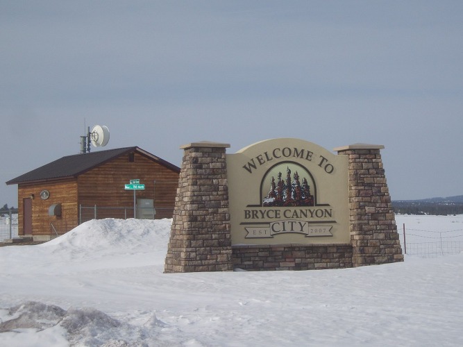
- Bryce Canyon City
- Cedar City
- Green River
- Hurricane
- Kamas
- Kanab
- Layton
- Lehi
- Moab
- Ogden
- Orem
- Panguitch
- Park City
- Provo
- Salt Lake City
- Sandy
- St. George
- Vernal
- West Jordan
- West Valley City
Welcome to the land of hoodoos in Bryce Canyon City, Utah, home to Bryce Canyon National Park.
As one of Utah’s Mighty Five national parks, it’s the smallest national park in the state, but also ranks as the second most visited.
In 2023, more than 2.4 million people came to the park, and most of them made a stop in Bryce Canyon City.
If visiting the city feels like visiting family, that’s because more than half of the population is related.
At least five generations of Reuben “Ruby” Syrett’s family now work at Ruby’s Inn or one of the accompanying businesses.
Believe me when I say that that little dot on the map marking Bryce Canyon City is absolutely not indicative of the things to do here.
While the city is home to just 300 people, the daily population explodes, especially in spring, summer, and fall.
The city can be a little kitschy, while the park is raw beauty.
You’re close (by Utah wilderness standards) to all the other Mighty 5 Parks, in a central location to explore as much as you want.
However, you can also choose to enjoy the Las Vegas-style entertainment at Ruby’s Inn or soak in the night skies, more pristine than almost any other place in the country.
The canyon and then the city are named after Ebenezer Bryce, a settler who arrived in 1862 and set up a homestead at the bottom of the canyon.
Before long, the timber workers who shuttled logs up the canyon walls began referring to it as “Bryce’s Canyon.”
Since federal lands in America rarely allow for possessive naming, it is now known as Bryce Canyon.
Warnings & Dangers in Bryce Canyon City

OVERALL RISK: LOW
There's a low risk in Bryce Canyon City if you're prepared with weather, wilderness, and personal safety steps, which we will discuss in this guide.

TRANSPORT & TAXIS RISK: LOW
You'll really want a car to get around this region, especially since the scenic drive is one of the top things to do. However, you can look into Bryce Canyon Scenic Tours & Shuttle Service if you don't want a car. There is also a national park shuttle to get around Bryce Canyon National Park and back to Bryce Canyon City. Taxis and rideshares will be limited, if not impossible to find. Even if you can find one, you likely won't have mobile service to summon one. The shuttles are the best bet since there are few roads and a lot of traffic here.

PICKPOCKETS RISK: LOW
The risk is low here, but don't let that cause you to let your guard down. Keep locking car doors and securing your belongings. Most thefts that happen near Bryce Canyon City are "other" types of theft beyond pickpocketing.

NATURAL DISASTERS RISK: MEDIUM
Extreme heat, summer monsoons, flash flooding, dust storms, and winter storms are the main risks here. Each one comes with plenty of advance notice, but you have to pay attention. Keep in mind that Bryce Canyon is among the highest-elevation national parks of the Mighty 5, which means more snow more often.

MUGGING RISK: LOW
This is a low risk, with no robberies reported as far as I can tell for at least a decade.

TERRORISM RISK: LOW
Here's another low risk, with an extremely remote area with a small population. The bigger concern here would be people violating federal law by lighting illegal fires, defacing federal property, or poaching animals.

SCAMS RISK: LOW
Scams are few and far between in a remote area like this, but the biggest complaints I found were about random poor service by local campsites and hotels. Read reviews before you book, but also understand there are two sides to a story. A hotel being oversold is annoying, but not a scam - it happens. Someone not getting a refund for an overbooked hotel? That's fraud.

WOMEN TRAVELERS RISK: LOW
We assume that women have the same outdoor experience as men when answering this question, so there's no additional risk beyond that. Summer visitors should know how to monitor the sky for storm formation and wind speed. Knowing how to self-rescue or - better yet - avoid common injuries is imperative.

TAP WATER RISK: LOW
The U.S. has strict standards for tap water per the Safe Water Drinking Act. Communities are required to provide a Water Quality Report (Consumer Confidence Report) once a year by July 1. However, in a place like Bryce Canyon City, the water usually comes from groundwater wells, and testing is done on a "by property" basis. You should ask your hotel or campground if there was a recent water test. In general, it's a low risk, but with such a remote area, I would definitely get that firsthand from officials in town.
Safest Places to Visit in Bryce Canyon City
There are several websites where you can learn about Bryce Canyon and Bryce Canyon City.
- brycecanyoncityut.gov: The city’s website covers local attractions.
- nps.gov/brca: Bryce Canyon National Park’s website.
- visitbrycecanyon.com: Covers national park lodging (inside the park) and regional attractions.
- visitbrycecanyoncity.com: Cover the city and surrounding area
State Route 63 is also Main Street in Bryce Canyon City.
This is where you’ll find Ruby’s Inn (rubysinn.com).
Don’t let the name “inn” fool you.
It’s much more like a resort.
In addition to basic rooms and suites, guests get a free hot breakfast buffet, a general store, a gift shop, and nightly entertainment.
You can also book outdoor adventures at Rubys Inn, such as a helicopter flight over Southern Utah, ATV rides, horseback rides, mountain bike rentals, winter ski rentals, and guided hikes.
Across the street from Ruby’s Inn is Old Bryce Town Shops, an Old West facade with a candy store, rock shop, ice cream parlor, and a giant rock yard for rockhounders.
The shuttle to Bryce Canyon National Park offers several stops in town, with the park entrance just a mile down the road.
The parking area is at the top of the canyon, with the Amphitheater dropping into view soon after parking.
All trails go down into the canyon at varying lengths and elevations; keep this in mind when you’re returning, as the ascent through higher elevations takes longer and is more taxing on your body.
Queens Garden and Navajo Loop are the most popular (busiest) trails, for good reason.
The views are amazing, and you’ll see unique formations along the way, with hoodoo spires sticking up around every corner.
If you want to stick closer to the canyon rim, try the Fairyland Loop Trail.
You can also take a hike outside the main amphitheater to avoid crowds.
I recommend the Mossy Cave Trail, which has a wonderful waterfall along the way.
The cave isn’t a traditional one, but the overhang provides more of a grotto.
Check the park events calendar before you go, as free ranger-guided tours are a great way to get familiar with the geography and scenery.
If you can score a spot on a ranger’s night walk under the dark skies, snag it ASAP.
It’s an experience of a lifetime.
Once you drive past the busy first three miles of the scenic road, you’ll be on the Southern Scenic Drive that goes above 9,000 feet in elevation to some scenic viewpoints.
About 12 miles away from Bryce Canyon National Park is Red Canyon, part of Dixie National Forest.
As for hikes, I recommend the Pink Ledge or Birdseye trails.
If you like biking, take the Canyon 2 Canyon Trail connecting Red Canyon to Bryce Canyon across 20 miles.
When snow is on the ground, cross-country skiing and snowshoeing are allowed.
The Bryce Wildlife Adventure is a mix of a wildlife museum, a historical museum, and a deer feeding exhibit.
Places to Avoid in Bryce Canyon City
Crime isn’t a big concern here.
If you use basic personal safety and crime prevention steps, you won’t find a dangerous place in the area.
The best thing to avoid is doing an activity beyond your physical ability or skill level.
Trails are marked as easy, moderate, or strenuous by the National Park Service, and you should review that before choosing a trail.
Always check park conditions before you go because rockfalls, deep snow, icy conditions, or other hazards can cause popular trails to be closed or certain sections to be off-limits.
Wall Street closed for quite some time due to flood damage.
Since this area is at a higher elevation than the other Utah national parks, snow can be a big problem.
Slickrock trails become even more hazardous when icy.
When you consider that Bryce Canyon was formed by frost wedging, you realize this is a winter wonderland and a hazard zone wrapped into one.
Erosion is ongoing, and it’s up to you to know the risks and talk to rangers about the best safety steps as you explore.
Whatever you do, don’t go into any slot canyon if rain is in the forecast or falling.
These canyons become filled with water quickly and carry heavy rocks and dangerous debris in addition to the fast-running water.
There is little time to escape from the depths of a slot canyon.
If you want to avoid the worst of the crowds, avoid holiday weekends, free park admission days, and rodeos.
Safety Tips for Traveling to Bryce Canyon City
- Garfield County Sheriff’s Office provides law enforcement for Bryce Canyon City. It doesn’t look like they have a social media presence, but the main phone number is 435-676-2678 if you have specific questions to ask. You can follow @garfieldcountyutah on Facebook to get updates from the Sheriff.
- Download the National Park Service app, and then you’ll have access to Bryce Canyon National Park maps, alerts, and current conditions. Download the offline maps while you have a good internet connection. Don’t wait until you get to the park.
- Sign up for Garco 911 emergency alerts through the Garfield County website. This will cover severe weather, winter weather, and public safety threats throughout the county. The alerts are critical to learning about new wildfires or winter storms.
- The monsoon happens every summer, generally in July and August, but can start in May and run through early September. The tricky part of a monsoon is that the day starts with clear skies. As the day wears on, clouds start to form and quickly explode into storms. Even if it doesn’t storm where you are, if you can hear thunder, you’re close enough to get hit by lightning.
- Wear shoes with a good grip. Tennis shoes and sandals are going to be dangerous on the slickrock surface. You need hiking boots or shoes with a tread that grips the rocks. Hiking poles are recommended, especially for the way up.
- Stop at the visitor’s center of Bryce Canyon National Park and utilize the park rangers to help you plan your trip. It’s a free service, and these people know the park better than anyone. You can ask all the questions you’d like and be more prepared for your adventure.
- If you’re visiting Bryce Canyon City from a lower elevation, I recommend you give yourself a day to acclimate to the elevation before you take a tough hike. Know the signs of altitude sickness and take precautions if you feel the effects setting in.
- Study the 7 Principles of Leave No Trace and act accordingly. This includes not taking any rocks, sand, or plants from the landscape. It also means carrying out all of your trash. Don’t carve your initials on any rocks or trees.
- Most horseback rides have a weight limit, generally between 220 and 240 pounds. Age limits generally impact children under seven years old. If you feel you have a special case, like you’re over six feet tall and exceed the weight limit, call the vendor ahead of time to see if a tour can be scheduled.
- Ration water to drink one quart every one to two hours, even if you don’t feel thirsty. Keep electrolytes or salty snacks with you to replace lost minerals. You can find hydration stations on the park map, but they aren’t located on every trail. Do NOT drink water found on the trail, as it can contain harmful bacteria.
So... How Safe Is Bryce Canyon City Really?
We don’t have specific crime data for Bryce Canyon City, as law enforcement comes from the county sheriff.
However, the only criminal activity I can find in all of Google’s depths is graffiti inside the national park.
Across the county, which includes the towns of Panguitch, Tickaboo, Escalante, and Boulder, there were six violent crimes in 2022 and three in 2021.
Property crimes averaged less than four a month.
Even among the crimes that did happen, it’s hard to find details.
Most were among people who know each other, likely domestic disputes that didn’t rank among “big” news stories.
In fact, the only report from the sheriff’s office that made any kind of headlines was a woman who stomped on a “Back the Blue” sign during a traffic stop and was subsequently facing hate crime charges.
While there are outdoor safety concerns, like fast-moving monsoon storms, even Bryce Canyon National Park statistics rank among the least deadly in the system.
Between 2011 and 2023, five people died in the park.
One was from a lightning strike, one was from a flash flood, two had a medical episode while hiking, and a fifth had unknown circumstances.
Bryce Canyon City and the National Park are as safe as you make it.
Keep all your personal safety standards high by locking car doors and keeping valuables in a safe.
Better yet, leave valuables at home.
You don’t need them in Bryce Canyon.
Check road conditions in winter, as this area gets a lot of snow.
Check the weather forecast in summer to see if storms are expected.
Bryce Canyon City might sound too good to be true, but it’s truly a safe and stunning place to visit.
How Does Bryce Canyon City Compare?
| City | Safety Index |
|---|---|
| Bryce Canyon City | 82 |
| Oakland | 57 |
| New Orleans | 57 |
| Baltimore | 56 |
| Boston | 67 |
| Washington DC | 56 |
| New York City | 67 |
| Phnom Penh (Cambodia) | 61 |
| Niagara Falls (Canada) | 87 |
| Calgary (Canada) | 82 |
| Buenos Aires (Argentina) | 60 |
| Vancouver (Canada) | 82 |
| Cordoba (Argentina) | 61 |
Useful Information

Visas
All international visitors need either a visa defining the purpose of the trip (tourist, work, school, etc.) or a visa waiver. Start the process using the Visa Wizard module on the U.S. State Department website. You’ll quickly find out which one you need. Also, keep in mind that your passport must be valid for at least six months after your trip, or you’ll need to apply for a new one.

Currency
Only the U.S. Dollar (USD) is accepted in the United States. International airports usually have a currency exchange desk on site, while regional airports won’t. Your home bank offers the lowest fees. For those using credit cards, check to see if there’s a foreign transaction fee before you start racking up charges. Don't wait until you are in Bryce Canyon City to try to find cash. If you are paying for a park pass at the entrance station, only credit or debit cards are accepted.

Weather
Forget everything you might assume about the desert landscape being hot all the time. Bryce Canyon sits nearly 7,700' above sea level, which means the summer heat isn't as bad, and the winters are much colder than in places like Zion National Park. The lows throughout the year range from 11° to 45°F. Yep, even in July. The warmest days average in the upper 70s, with winter highs only making it into the mid-30s. Pack layers of clothing and sturdy hiking boots that have been worn many times before your first hike here. Sunscreen is a must as well.

Airports
Cedar City has an airport about 90 minutes away. Flights are offered to Salt Lake City via SkyWest. If you drive to Salt Lake City, plan for four hours on the road. For price comparison purposes, you can also get to Harry Reid International Airport (formerly McCarran International) in that same amount of time.

Travel Insurance
While we normally recommend comprehensive travel insurance just to give peace of mind, it's almost necessary in a place like Bryce Canyon City. First, you're driving a lot, so your rental car needs to be covered from weather damage, roadside assistance, and uninsured motorist accidents. Second, there are plenty of natural hazards, and healthcare in the U.S. is pricey out of pocket, even for basic things like dehydration or a sprained ankle. Finally, consider travel adventure insurance if you're going to do risky activities like off-roading or rock climbing.
Bryce Canyon City Weather Averages (Temperatures)
Average High/Low Temperature
| Temperature / Month | Jan | Feb | Mar | Apr | May | Jun | Jul | Aug | Sep | Oct | Nov | Dec |
|---|---|---|---|---|---|---|---|---|---|---|---|---|
| High °C | 2 | 4 | 8 | 12 | 18 | 24 | 27 | 25 | 21 | 15 | 8 | 3 |
| Low °C | -14 | -12 | -7 | -4 | 1 | 5 | 9 | 8 | 3 | -3 | -8 | -13 |
| High °F | 36 | 39 | 46 | 54 | 64 | 75 | 81 | 77 | 70 | 59 | 46 | 37 |
| Low °F | 7 | 10 | 19 | 25 | 34 | 41 | 48 | 46 | 37 | 27 | 18 | 9 |
Utah - Safety by City
| City | Safety Index |
|---|---|
| Bicknell | 81 |
| Brigham City | 82 |
| Bryce Canyon City | 82 |
| Cedar City | 86 |
| Green River | 83 |
| Hurricane | 83 |
| Kamas | 79 |
| Kanab | 79 |
| Layton | 81 |
| Lehi | 74 |
| Moab | 84 |
| Ogden | 72 |
| Orem | 82 |
| Panguitch | 78 |
| Park City | 78 |
| Provo | 94 |
| Salt Lake City | 55 |
| Sandy | 93 |
| St. George | 94 |
| Vernal | 83 |
| West Jordan | 94 |
| West Valley City | 65 |
