 Utah : Safety by City
- Bicknell
- Brigham City
- Bryce Canyon City
- Cedar City
- Green River
- Hurricane
- Kamas
- Kanab
- Layton
- Lehi
- Moab
- Ogden
- Orem
- Panguitch
- Park City
- Provo
- Salt Lake City
- Sandy
- St. George
- Vernal
- West Jordan
- West Valley City
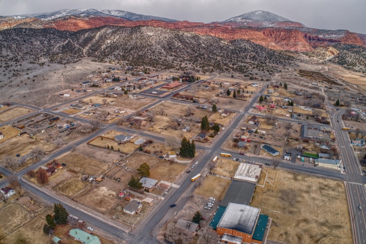
Bicknell, Utah, is a small town known for its connection to the big screen and proximity to several of Utah’s Mighty 5 National Parks.
The town of 300 is off the beaten path, about 50 miles from two interstates, but it also sits toward the beginning of one of Utah’s most famous scenic drives on Byway 24 through Capitol Reef Country.
Twenty miles from Bicknell is the entrance to Capitol Reef National Park and the famous Waterpocket Fold natural formation.
Bicknell is also centrally located, by Utah standards, to the four other national parks that make up the Mighty Five.
- Arches National Park: 161 miles/2:30 drive time
- Canyonlands National Park (Island in the Sky Visitor Center): 175 miles/2:50 drive time
- Bryce Canyon National Park: 100 miles/1:55 drive time
- Zion National Park: 173 miles/3:15 drive time
Plus, it’s not all desert out there.
Bicknell is near the highlands, with lakes, mountains, and waterfalls to find between two national forests and a collection of state parks.
You can also walk in the footsteps of dinosaurs or ride through remote trails on ATVs, horseback, or mountain bikes.
Ironically enough, this high-elevation desert town takes its name from a New England historian.
In the early 1900s, Rhode Island native Thomas W. Bicknell offered a library of books to any Utah town that took his name.
The town previously known as Thurber has since been called Bicknell.
There is a Bicknell, Indiana, but it was named for a local man named John Bicknell.
Utah’s Bicknell is a treasure trove of outdoor adventures, but that’s pretty common for all the small towns of this region.
Let’s explore what makes Bicknell stand out.
Warnings & Dangers in Bicknell

OVERALL RISK: LOW
There's a low risk here from a crime standpoint, and plenty of outdoor adventures come with inherent risks. Preparation and attention to safety go a long way in keeping the risk low.

TRANSPORT & TAXIS RISK: LOW
You'll need a vehicle to get to Bicknell. There isn't a local transportation system, and you'd have to research if any shuttles or tour guides offer rides through town. I doubt you'll be able to find taxis or rideshares here, and even if you could, cell phone service is spotty at best.

PICKPOCKETS RISK: LOW
This is a low risk, but there isn't exact pickpocket crime data. However, at least half a dozen similar towns in this region haven't had reports of pickpockets or purse snatchings for many years.

NATURAL DISASTERS RISK: MEDIUM
Risks run the gamut from winter storms to summer thunderstorms to flash flooding. I want to harp on the flooding a bit since, in August 2023, a flood came through town and wiped out part of Main Street, including nearby homes and businesses. The same walls of water can weave through slot canyons, catching hikers off guard. Wildfires are another risk. This is just an important area to stay weather-aware of throughout your visit.

MUGGING RISK: LOW
This is another low risk, with no robberies in recent headline history. In general, small towns in Utah have a low percentage of any kind of crime.

TERRORISM RISK: LOW
Another low risk here, with a remote area surrounded by rugged mountains and unpopulated, challenging terrain.

SCAMS RISK: LOW
Check local law enforcement social media sites for the latest scams. The local Better Business Bureau office lists scam tactics and protection advice. While the only scam I can find is a spoofed phone call by a fraudster posing as law enforcement, knowing the tactics of scammers helps keep the risk low.

WOMEN TRAVELERS RISK: LOW
This is another low-risk, but this region is not a good place for solo travelers to go exploring alone. Some trails are too dangerous for kids, and safety steps need to be taken with every activity.

TAP WATER RISK: LOW
The U.S. has strict standards for tap water per the Safe Water Drinking Act. Communities are required to provide a Water Quality Report (Consumer Confidence Report) once a year by July 1. You should contact the city hall's main phone number to ask for the most recent testing of water quality reports, which will likely come from nearby Torrey. The risk is low.
Safest Places to Visit in Bicknell
Use the website capitolreefcountry.com to find information about Bicknell, nearby communities, and public lands.
A visit to Bicknell wouldn’t be complete without a meal at the quirky Sunglow Motel and Restaurant.
Famous for its “pickle pie” and other unusual desserts, this spot offers a true taste of local flavor and hospitality.
Just a few miles from Bicknell, the town of Torrey offers additional dining and shopping options.
The Torrey Gallery showcases local art, while the nearby Café Diablo serves creative Southwestern cuisine.
Just a short drive from Bicknell, Capitol Reef National Park is a must-visit destination.
Known for its stunning rock formations, ancient petroglyphs, and scenic drives, the park offers hiking trails for all skill levels.
The Capitol Gorge Trail and Hickman Bridge Trail are particularly popular.
Fishlake National Forest is another nearby gem.
The forest’s namesake, Fish Lake, is renowned for its crystal-clear waters and excellent fishing opportunities.
Hiking and boating are also popular activities here.
The Aspen-Mirror Lake Trail provides a picturesque hike with great views of the surrounding forest.
Between the park and the forest is Thousand Lake Mountain, a misleading name for a peak that isn’t packed with lakes.
Nearby Boulder Mountain has many small lakes, and the common belief is that the early mappers got the two confused.
The Bicknell Bottoms, a unique wetland area just outside of town, is a haven for bird watchers and nature enthusiasts.
The diverse ecosystem supports a wide variety of wildlife, making it a perfect spot for a peaceful walk or a leisurely afternoon of wildlife photography.
One of my top suggestions is to look beyond Capitol Reef National Park, as there are several great spots to explore near Hanksville.
Goblin Valley State Park is renowned for its unique rock formations, known as hoodoos or “goblins.”
The park’s otherworldly landscape is perfect for hiking, photography, and exploring.
Little Wild Horse Canyon is a favorite for slot canyon enthusiasts.
This non-technical slot canyon offers a moderately easy hike with stunning narrow passages and vibrant rock colors.
Factory Butte is an iconic landmark with a stark, moon-like landscape and is a favorite for off-road enthusiasts and photographers looking to capture the dramatic scenery.
We’re not the only ones who think this area looks like the moon!
Operated by the Mars Society, the Mars Desert Research Station facility near Hanksville simulates a Mars habitat for scientists and researchers.
While visits require prior arrangement, it’s an interesting site for those fascinated by space exploration.
Those who are living there treat the landscape as if it was Mars!
If you’re big on roadside attractions, don’t miss the Hollow Mountain gas station and convenience store, with the entrance built into the side of a sandstone mountain.
Places to Avoid in Bicknell
Bicknell is small by size as well as population, so you won’t get a charming downtown as you might find in some other communities.
The point of staying in Bicknell is to be close to all the natural attractions.
Main Street is technically Scenic Byway 24, and the town is just seven blocks wide and four blocks long.
You won’t find dangerous parts of town here.
Now, I want to talk about some clarifications that seem to fit best in this section, but they aren’t places to avoid.
For example, the trails here will be listed in various publications, but some are designed solely for hikers.
Others are just for ATVs, and even more accommodate vehicles and hikers.
You don’t want to end up hiking a sandy trail meant for ATVs.
You must avoid slot canyons if there is rain in the forecast and get out immediately if it starts raining.
These canyons turn into torrential flash-flooding waterways, carrying rocks, debris, and a dangerous current.
People have died in slot canyons for not heeding this warning.
Even a little bit of rain can cause flooding.
Safety Tips for Traveling to Bicknell
- Law enforcement in Bicknell comes from the Wayne County Sheriff’s Office. You can call them at 800-356-8757 or email wcso@wayne.utah.gov to ask specific safety questions. Follow them on Facebook @wcsoutah to get safety updates.
- Sign up for CodeRED emergency notifications to get severe weather alerts, road closures, storm damage reports, and other public safety information immediately. This will only work if you’re in an area with a strong mobile signal, so a battery-powered NOAA weather radio is the ideal backup plan.
- Download the National Park Service app to get information about Capitol Reef National Park or any other park you plan to visit. Each park has its own section with alerts at the top, which provides information about closures, safety risks, and other critical information visitors need to know.
- The NPS app also offers downloadable offline maps, so you can explore the interactive map even when you’re out of mobile phone range. Be sure to download these maps when you have a strong internet connection. Do not wait until you get to the park to do so.
- Wayne County Sheriff’s Office posts monthly call logs, which show the types of crime or law enforcement requests for service. If there were a crime trend building, you would be able to see it here. The biggest contact point between deputies and the public involves traffic stops and speeding.
- Robbers Roost is a popular slot canyon people love because it was once a hideout for Butch Cassidy and his crew. However, this is not an easy trail by any standards. You should look up the rescue video from April 2024 and see how rescuers are put into a dangerous situation trying to help people who had an accident while exploring this remote area.
- In another example of how dangerous this area can be, watch the movie 127 Hours to see the true story of how Aron Ralston hiked a slot canyon and his arm became trapped by a falling rock. He survived but was forced to cut off his arm to do so. While it’s an extreme example, it shows how quickly things can go sideways in the remote wilderness.
- You’ll need a fishing license to cast bait in any of the lakes or rivers of Utah, which includes national forests. You get that license through the Utah Division of Wildlife Resources.
- Bicknell is 7,000 feet in elevation, which can cause altitude sickness and side effects for people visiting from lower altitude areas. It’s important to give yourself a day to acclimate before tackling tough trails or higher elevations.
- Check fire restrictions before camping or taking an ATV into the wilderness. This could mean a ban on campfires or OHVs that don’t have a working spark arrestor. It will also limit smoking in most areas.
So... How Safe Is Bicknell Really?
The Wayne County Sheriff’s Office hasn’t released official crime data since at least 2020.
However, as we noted above, you can check the monthly list of calls for service to get a better idea of crime concerns.
By and large, these remote areas are more about wilderness safety than crime concerns.
Basic steps like locking your car doors and rolling up the windows still stand.
Don’t leave keys in a vehicle at the trailhead, and don’t leave a bike unlocked.
Even trying to find news reports about criminal activities in Wayne County came up with few responses, and none were in Bicknell.
The biggest headline was when a flash flood came through town and caused a lot of damage during the summer monsoon.
Jimmy Harris, one of the local town government members, said in August 2023, “Utah S.R. 24, which also serves as Main Street for Bicknell, was flooded and had debris wash onto it mainly in the form of rocks and mud.
Water completely covered all travel lanes of the roadway with approximately 8 to 10 inches of mud in the westbound travel lane.”
You need to know your physical limits for exploring trails and avoid hikes that are too challenging or long.
Some hikes here require scrambling or walking in deep sand.
Others require climbing out of canyons that were easy to slide into on the way there.
Understand the summer weather patterns and how monsoons work.
What looks like a small storm can balloon into a deadly rainmaker, with lightning striking anywhere exposed outside.
Bicknell is as safe as you make it, and this is one area that should be researched for weeks before you set an agenda.
How Does Bicknell Compare?
| City | Safety Index |
|---|---|
| Bicknell | 81 |
| Las Vegas | 62 |
| San Francisco | 61 |
| Philadelphia | 60 |
| Houston | 59 |
| Atlanta | 58 |
| St. Louis | 58 |
| Brussels (Belgium) | 60 |
| Shanghai (China) | 66 |
| Belize City (Belize) | 37 |
| La Paz (Bolivia) | 52 |
| Sao Paulo (Brazil) | 45 |
| Rio de Janeiro (Brazil) | 43 |
Useful Information

Visas
All international visitors need either a visa defining the purpose of the trip (tourist, work, school, etc.) or a visa waiver. Start the process using the Visa Wizard module on the U.S. State Department website. You’ll quickly find out which one you need. Also, keep in mind that your passport must be valid for at least six months after your trip, or you’ll need to apply for a new one.

Currency
Only the U.S. Dollar (USD) is accepted in the United States. International airports usually have a currency exchange desk on site, while regional airports won’t. Your home bank offers the lowest fees. For those using credit cards, check to see if there’s a foreign transaction fee before you start racking up charges. Don't wait until you're in Bicknell to look for cash.

Weather
The higher elevation here wards off the scorching heat of Southern Utah, but highs will still get into the mid-80s. Expect temperatures to rise five degrees for every 1,000 feet in elevation loss. Bring clothing that can get dirty, muddy, wet, and torn. Shoes should have a thick grip (no tennis shoes), and you'll want sunscreen with at least SPF 50. Winters can be snowy, but places like Bryce Canyon will get much more snow than Bicknell and Capitol Reef.

Airports
While there are smaller airports in Moab, St. George, and Cedar City, I would recommend just taking the three-and-a-half-hour drive to Salt Lake City International, as that's where most flights from the other airports will take you anyway. Plus, the smaller airports are at least two and a half hours away, anyway.

Travel Insurance
Comprehensive insurance offers the best protection and peace of mind. When visiting a place like Capitol Reef Country, I highly recommend you research adventure insurance to see if that will cover any accidents or rescues needed during higher-risk activities.
Bicknell Weather Averages (Temperatures)
Average High/Low Temperature
| Temperature / Month | Jan | Feb | Mar | Apr | May | Jun | Jul | Aug | Sep | Oct | Nov | Dec |
|---|---|---|---|---|---|---|---|---|---|---|---|---|
| High °C | 4 | 6 | 10 | 15 | 20 | 26 | 28 | 27 | 23 | 17 | 10 | 5 |
| Low °C | -13 | -11 | -7 | -3 | 1 | 5 | 9 | 8 | 3 | -2 | -8 | -12 |
| High °F | 39 | 43 | 50 | 59 | 68 | 79 | 82 | 81 | 73 | 63 | 50 | 41 |
| Low °F | 9 | 12 | 19 | 27 | 34 | 41 | 48 | 46 | 37 | 28 | 18 | 10 |
Utah - Safety by City
| City | Safety Index |
|---|---|
| Bicknell | 81 |
| Brigham City | 82 |
| Bryce Canyon City | 82 |
| Cedar City | 86 |
| Green River | 83 |
| Hurricane | 83 |
| Kamas | 79 |
| Kanab | 79 |
| Layton | 81 |
| Lehi | 74 |
| Moab | 84 |
| Ogden | 72 |
| Orem | 82 |
| Panguitch | 78 |
| Park City | 78 |
| Provo | 94 |
| Salt Lake City | 55 |
| Sandy | 93 |
| St. George | 94 |
| Vernal | 83 |
| West Jordan | 94 |
| West Valley City | 65 |
