 Wisconsin : Safety by City
- Apostle Islands
- Appleton
- Baraboo
- Bayfield
- Beloit
- Cedarburg
- Eau Claire
- Fond du Lac
- Fort Atkinson
- Green Bay
- Janesville
- Kenosha
- Lake Geneva
- Madison
- Milwaukee
- Minocqua
- New Glarus
- Oshkosh
- Platteville
- Prairie du Chien
- Racine
- Sheboygan
- Sturgeon Bay
- Sun Prairie
- Superior
- Tomah
- Waukesha
- Wausau
- Whitewater
- Wisconsin Dells
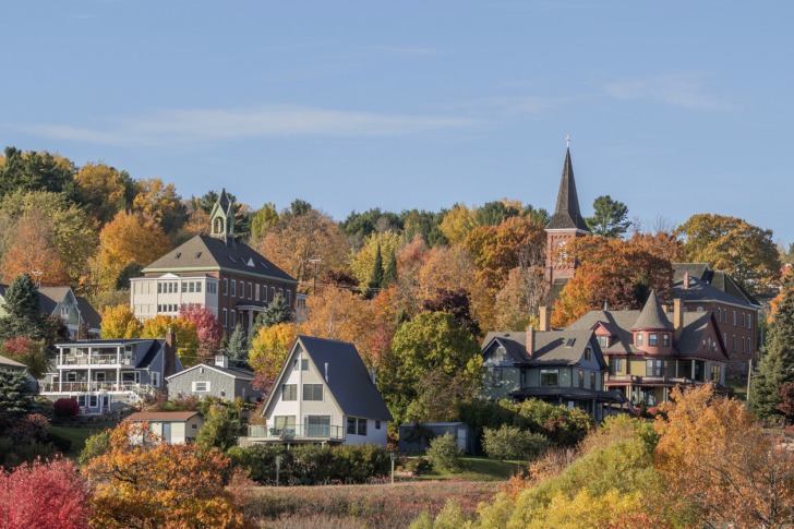
Bayfield, Wisconsin, has a charming lakeside location on the Bayfield Peninsula in northern Wisconsin, along the shores of Lake Superior.
It is known as the Berry Capital of the World and the Gateway to the Apostle Islands.
Bayfield is both a city and a town within Bayfield County, with about 17,000 residents and millions of visitors each year.
Unlike larger port cities on Lake Superior, Bayfield has embraced a quieter, more community-focused identity, with a strong emphasis on preserving its history and natural surroundings.
As you might expect, that history is steeped in Great Lakes trade, fishing, and logging, but geological history carved a different path for Bayfield.
The Apostle Islands themselves are remnants of ancient rivers and glaciers that shaped the landscape long ago, leaving behind a chain of 22 islands with unique rock formations, beaches, and cliffs.
Bayfield is also perfectly positioned to take the brunt of lake-effect snow in winter, with average snowfall measuring about 100 inches – that’s more than eight feet!
Bayfield County is largely rural, with a diverse landscape of forests, farmlands, and waterways that stretch from Lake Superior’s shores to the Chequamegon-Nicolet National Forest.
Bayfield’s unique mix of natural beauty, outdoor adventure, and laid-back charm make it a memorable spot to explore year-round.
Plus, you can satisfy any adventure craving, whether it’s hiking, paddling, fishing, or ATV riding.
If you time the trip right, you might be able to walk to an island!
Keep reading to learn more.
Warnings & Dangers in Bayfield

OVERALL RISK: LOW
There's a low risk in Bayfield, but you'll need to love and be educated about the great outdoors to safely enjoy your time here.

TRANSPORT & TAXIS RISK: LOW
Bayfield is served by Bay Area Rural Transit (BART), offering bus routes connecting Bayfield to nearby communities like Ashland and Washburn. The city is walkable, with boat service or ferries to the nearby islands. Having a rental car is an ideal way to get to Bayfield since it's in a more remote location.

PICKPOCKETS RISK: LOW
This is a low risk, with the traditional safety steps to protect your stuff still necessary. Keep your wallet concealed, and use a backpack or a purse that is attached to your body.

NATURAL DISASTERS RISK: MEDIUM
This is a medium risk, mostly due to the dangers and safety issues presented by Lake Superior. First, Bayfield is one of the snowiest places in Wisconsin since it gets lake-effect snow. Then, there are rip currents, squalls, and waves that can be churned on and in the lake. Late spring brings the risk of severe thunderstorms, tornadoes, and waterspouts. Flooding is also a risk, given how much snow melts in spring and how much rain can fall at one time.

MUGGING RISK: LOW
Without exact robbery data, I can't truthfully answer this concern. However, looking at recent news headlines, muggings and robberies don't seem to be a big issue here. Use common sense and safety steps to keep the risk low.

TERRORISM RISK: LOW
The port might come with some extra safety concerns, but that will also mean a lot of additional security. The small town isn't thought to be a potential target. The risk is low, but you can help keep it that way by reporting suspicious activity to the local police or national park rangers.

SCAMS RISK: LOW
Check local police department and sheriff’s office social media sites for the latest scams. That will help keep the risk low. The Bayfield County website has a section about Fraud where you can learn the best safety advice.

WOMEN TRAVELERS RISK: LOW
The risk for women is low, provided they know water, wilderness, weather, and winter safety best practices.

TAP WATER RISK: LOW
The U.S. has strict standards for tap water per the Safe Water Drinking Act. Communities are required to provide a Water Quality Report (Consumer Confidence Report) once a year by July 1. The 2023 report shows full compliance and no violations.
Safest Places to Visit in Bayfield
Bayfield.org is the tourism site for the county and the non-National Park Service areas of the Apostle Islands.
The city and the county also offer a Visitor’s section on their respective websites.
You can view videos of seasonal activities or get specific travel guides for various outdoor recreation possibilities.
Bayfield is the primary gateway to the Apostle Islands National Lakeshore, a group of 22 islands known for their natural beauty, sea caves, and historic lighthouses.
Madeline Island is the most accessible from Bayfield, and it is reachable by a short ferry ride.
However, it’s important to note that Madeline Island is privately owned.
It is a somewhat developed island, with shops and restaurants.
Madeline Island is home to Big Bay State Park, a beautiful 2,350-acre park on the island’s eastern side.
The park features a long sandy beach, dramatic sandstone cliffs, and scenic trails that wind through forests and marshland.
Big Bay Town Park is adjacent to the state park, with more beach access and recreational activities.
The other islands, reachable by water taxi, private boats, or guided tours, provide experiences like camping, kayaking, and exploring preserved lighthouses.
See our story “How Safe Are the Apostle Islands for Travel” for more information on that adventure.
Most of the Bayfield waterfront is part of a National Historic District.
Stop by the Bayfield Heritage Association to get more information on the history of this region and ask for self-guided tour maps to see the most notable sites.
Bayfield Maritime Museum is open during the warmer months, with exhibits showcasing the port’s history here.
You can explore Indigenous artifacts, fishing tools throughout the ages, boat-building displays, and lighthouses.
An easy hike is the Big Ravine Nature Preserve, which starts in Bayfield and weaves its way through the woods to a ravine.
Expect water crossings here, especially after heavy rain or snowmelt.
When you’re ready to pick some berries, check the Berry Farm and Orchard Report on the Chamber of Commerce website.
That will help you know what is in season and which spots are best for the You-Pick-Em activities.
Fall visitors should know that the Chamber’s website will also post regular fall foliage reports starting in late August or early September.
To soak in the sights, try the 70-mile-long Wisconsin Lake Superior Scenic Byway along State Highway 13.
It covers the length of the Bayfield Peninsula.
Places to Avoid in Bayfield
The town and city are small, with no dangerous neighborhoods or bad parts of the town.
If you’re not a fan of winter or snow, you should do a lot of research about the lake-effect snow here and bitterly cold temperatures.
For those who live here, winter is a great season of life, with many activities.
However, if you’re not dressed correctly or don’t know how to handle large dumps of snow, it could pose serious safety risks.
For example, in the winter of 2022/2023, Bayfield saw nearly 160 inches of snow.
Most of that piles up since temperatures rarely get above freezing to cause a thaw.
Safety Tips for Traveling to Bayfield
- Bayfield has a local police department, with support from the Bayfield County Sheriff’s Office. The SO is on Facebook @BayfieldCountySheriff, but the police department is not on social media.
- Use the National Park Service app to get safety information about Apostle Islands National Lakeshore. Look for the Alerts before you visit the park and download maps while you have a good internet connection so they will be available offline.
- Don’t go paddling on the lake until you’ve checked the sea cave waves on the website. Look for “Sea Caves Watch” in your search to get the latest updates.
- If you’re going on the water to just paddle around or to reach an island, you won’t have access to 911 service. It is recommended that all water travelers bring a VHF marine radio with them and know how to use it. Add these numbers to your contacts list now: U.S. Coast Guard (715) 779-3950 and Apostle Islands Headquarters (715) 779-3397.
- Bears live on land and even on islands. There are only black bears here, but that shouldn’t stop you from using excellent bear safety steps, like bringing bear-proof containers and using trash cans designed to keep wildlife out.
- As the “Berry Capital of the World,” Bayfield has many great spots to pick berries and enjoy the fruits. However, you should know which ones are edible and which could be toxic. For example, bluebead lily berries look like blueberries but are poisonous. When in doubt, don’t eat anything from the wild.
- Before visiting one of the 15 beaches in Bayfield County, check the local health department for water quality testing. Those reports are done weekly between Memorial Day and Labor Day.
- Visit the Wisconsin Department of Natural Resources website before planning any boating, fishing, hunting, or snowmobiling. Each activity has specific safety requirements or licenses needed to participate.
- Chequamegon Bay usually freezes over in the winter, which means the road between Bayfield and La Pointe is an ice road. Some years, the frozen water also allows access to ice caves. However, you need to understand ice safety and never walk or drive on ice without knowing how thick it is.
- Even when it is warm out, please don’t forget to bring long sleeves and pants with you into the wilderness or on the water. Ticks, biting flies, and mosquitoes can ruin a perfectly good day. Plus, temperatures on the water will drop up to 15 degrees.
So... How Safe Is Bayfield Really?
Neither the Bayfield County Sheriff’s Office nor the Bayfield Police Department have released recent crime statistics, leaving this question largely unanswered.
At least, I can’t give you statistics one way or the other.
In 2020, the FBI changed the system they used to collect crime data from local agencies.
The new system is supposed to offer more accuracy, but it was a heavy lift for law enforcement across the country, especially during the pandemic.
Also, crime data isn’t required of law enforcement agencies.
Even looking back to pre-2021 crime rates, the numbers were low across the board in the county and the city.
That gives some reassurance, especially since the largely unpopulated area still gets more than a million visitors each year.
Common safety advice prevails here.
Lock your car every time you park.
Only carry the bare necessities.
Know water, wilderness, and wildlife safety.
Keep an eye on the weather.
How Does Bayfield Compare?
| City | Safety Index |
|---|---|
| Bayfield | 78 |
| Boston | 67 |
| Washington DC | 56 |
| New York City | 67 |
| Detroit | 56 |
| San Diego | 67 |
| Miami | 55 |
| Buenos Aires (Argentina) | 60 |
| Vancouver (Canada) | 82 |
| Cordoba (Argentina) | 61 |
| Toronto (Canada) | 81 |
| Melbourne (Australia) | 80 |
| Montreal (Canada) | 81 |
Useful Information

Visas
All international visitors need either a visa defining the purpose of the trip (tourist, work, school, etc.) or a visa waiver. Start the process using the Visa Wizard module on the U.S. State Department website. You can also download the CBP One mobile app for help on the go. Also, your passport must be valid for at least six months after your trip, or you’ll need to apply for a new one.

Currency
Only the U.S. Dollar (USD) is accepted in the United States. International airports usually have a currency exchange desk on site, while regional airports won’t. Your home bank offers the lowest fees. For those using credit cards, check to see if there’s a foreign transaction fee. Credit cards, not debit cards, offer the best fraud protection.

Weather
Bayfield experiences mild summers and cold winters, with Lake Superior shaping the seasons. Summer temperatures stay cool, often in the 70s, while winters drop below freezing. Lake effect snow means this is one of the snowiest cities in the state. In fall, the lake delays frost, extending the season's colors, while spring arrives slower, keeping temps brisk longer.

Airports
The closest commercial airport to Bayfield, Wisconsin, is Duluth International Airport (DLH) in Minnesota, about 75 miles southwest. Minneapolis-Saint Paul International Airport (MSP), a larger hub with more flights, is around 220 miles away. The drive to MSP might not be ideal in winter.

Travel Insurance
Travel insurance protects the cost of baggage loss/theft, delays, cancelations, and emergency health issues. Rental car insurance should include roadside assistance and uninsured motorist coverage. Comprehensive insurance offers the best peace of mind. Consider adventure insurance if you are taking part in risky activities on the lake or the islands.
Bayfield Weather Averages (Temperatures)
Average High/Low Temperature
| Temperature / Month | Jan | Feb | Mar | Apr | May | Jun | Jul | Aug | Sep | Oct | Nov | Dec |
|---|---|---|---|---|---|---|---|---|---|---|---|---|
| High °C | -5 | -2 | 3 | 11 | 18 | 23 | 26 | 25 | 20 | 13 | 4 | -2 |
| Low °C | -14 | -12 | -7 | -1 | 5 | 10 | 14 | 13 | 9 | 3 | -3 | -11 |
| High °F | 23 | 28 | 37 | 52 | 64 | 73 | 79 | 77 | 68 | 55 | 39 | 28 |
| Low °F | 7 | 10 | 19 | 30 | 41 | 50 | 57 | 55 | 48 | 37 | 27 | 12 |
Wisconsin - Safety by City
| City | Safety Index |
|---|---|
| Apostle Islands | 78 |
| Appleton | 83 |
| Baraboo | 82 |
| Bayfield | 78 |
| Beloit | 60 |
| Cedarburg | 79 |
| Eau Claire | 77 |
| Fond du Lac | 64 |
| Fort Atkinson | 86 |
| Green Bay | 81 |
| Janesville | 81 |
| Kenosha | 74 |
| Lake Geneva | 82 |
| Madison | 77 |
| Milwaukee | 34 |
| Minocqua | 84 |
| New Glarus | 83 |
| Oshkosh | 83 |
| Platteville | 85 |
| Prairie du Chien | 80 |
| Racine | 70 |
| Sheboygan | 80 |
| Sturgeon Bay | 83 |
| Sun Prairie | 84 |
| Superior | 82 |
| Tomah | 83 |
| Waukesha | 83 |
| Wausau | 68 |
| Whitewater | 85 |
| Wisconsin Dells | 85 |
