 Washington : Safety by City
- Anacortes
- Bainbridge Island
- Bellevue
- Diablo
- Forks
- Gig Harbor
- Kennewick
- Kent
- Kettle Falls
- Longview
- Mercer Island
- Moses Lake
- Neah Bay
- Ocean Shores
- Olympia
- Port Angeles
- Port Townsend
- Poulsbo
- Pullman
- Quinault
- Renton
- San Juan Islands
- Seabrook
- Seattle
- Sequim
- Snoqualmie
- Spokane
- Spokane Valley
- Tacoma
- Walla Walla
- Wenatchee
- Westport
- Yakima
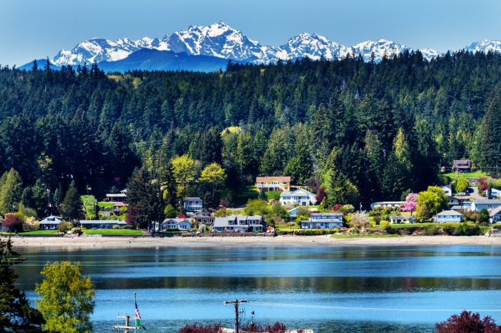
Bainbridge Island, both a city and an island, is located in the Puget Sound, just a short ferry ride from Seattle.
The island spans about 27 square miles and is known for its lush landscapes, charming small-town feel, and strong sense of community.
The proximity to a major urban center makes it great for a day trip or weekend getaway, offering a wonderful blend of natural beauty, artistic culture, and historical depth.
It’s important to note that the city encompasses the entire island, with neighborhoods distinguishing different sections.
The main districts are downtown, Fletcher Bay, Lynwood Center, and Rolling Bay.
The island’s vibe is laid-back yet sophisticated, attracting visitors who appreciate a slower pace of life without sacrificing cultural and recreational amenities.
It’s a place where nature and creativity thrive side by side.
Here, you’ll find dense forests, tranquil beaches, and scenic trails offering endless opportunities for outdoor activities, from hiking and cycling to kayaking and birdwatching.
Bainbridge Island’s history includes Native American heritage, European settlement, and significant events like the internment of Japanese Americans during WWII.
It evolved from a logging and shipbuilding hub to a tourism and residential area that sees 4.6 million pass through annually.
Read the book Snow Falling on Cedars to get in the mood for a trip to Bainbridge Island.
A local author wrote the novel in 1994, and the movie received an Oscar nod for cinematography.
Warnings & Dangers in Bainbridge Island

OVERALL RISK: LOW
There’s a low risk in Bainbridge Island, as it’s one of the safest cities in the region. It also ranks as one of the safest cities in Washington. Plus, you’ll find an abundance of safe things to do.

TRANSPORT & TAXIS RISK: LOW
Bainbridge Island offers several public transportation options, including the Washington State Ferries, which connect to Seattle. Kitsap Transit provides bus services around the island and to nearby areas. There are also bike-friendly paths and park-and-ride facilities, making it easy to navigate both on foot and by vehicle. All options are low-risk.

PICKPOCKETS RISK: LOW
Just two pickpockets have been reported in Bainbridge Island over the past five years, making this a low risk. You don’t want to let your guard down, especially in crowded spaces or on the ferry.

NATURAL DISASTERS RISK: MEDIUM
Bainbridge Island faces risks from natural disasters such as earthquakes, tsunamis, and landslides due to its location in the Pacific Northwest. The island's proximity to seismic fault lines, including the Cascadia Subduction Zone, increases the potential for significant earthquakes and related hazards, including coastal flooding and ground instability. While these aren’t frequent issues, the potential danger could be immense. That’s why we’re giving this a medium risk.

MUGGING RISK: LOW
Going back to 2010, there hasn’t been a year with more than three robberies. In the past decade, just one of those has been a mugging. The risk is low, but again, keep your wits about you to avoid creating a crime of opportunity.

TERRORISM RISK: LOW
Bainbridge Island, like many small communities, has a relatively low risk of terrorism. However, as part of the greater Seattle area, it is not entirely immune to such threats. It’s important to stay aware of your surroundings and report any suspicious activity, regardless.

SCAMS RISK: LOW
The police department and local sheriff’s office will post the latest scams on social media. Check the fraud section of each department’s website for more information and to learn about common tactics. Most scams reported here target residents, such as fake law enforcement calls, and the risk is low.

WOMEN TRAVELERS RISK: LOW
Women should feel safe visiting Bainbridge Island, with low crime rates and things to do for women of all ages. It’s family-friendly or great for a girlfriend’s getaway. Even solo travelers won’t feel uncomfortable while visiting this stunning spot.

TAP WATER RISK: LOW
The U.S. has strict standards for tap water per the Safe Water Drinking Act. Communities are required to provide a Water Quality Report (Consumer Confidence Report) once a year by July 1. The 2023 report shows one violation involving chlorine (too low), and steps were taken to improve the infrastructure which should fix the problem. All other standards were met or exceeded. The risk is low.
Safest Places to Visit in Bainbridge Island
Two websites can help you plan the perfect itinerary for Bainbridge Island. First, there’s VisitBainbridgeIsland.org, then there’s BainbridgeDowntown.org.
The former is the tourism website for the entire island, while the latter is for the downtown area.
Downtown Bainbridge Island is just two blocks from the ferry port.
Winslow Way is the Main Street of Bainbridge Island, offering a charming, small-town feel with a blend of local boutiques, art galleries, and eateries.
It’s known for its walkable streets, waterfront views, and a welcoming, community-oriented atmosphere.
The Bainbridge Island Museum of Art showcases contemporary art with a focus on artists from the Puget Sound region.
Its bright, modern building houses rotating exhibitions, a diverse permanent collection, and a dedicated children’s area.
Housed in a 1908 schoolhouse, Bainbridge Island Historical Museum preserves the island’s rich history.
Exhibits explore Native American heritage, early settler life, and the community’s role during World War II.
Bainbridge Island Japanese American Exclusion Memorial commemorates the forced removal of Japanese Americans from Bainbridge Island during World War II.
The site features a wall with the names of those interned and interpretive panels that tell their stories.
Fort Ward, once a military installation, is now a scenic park on Bainbridge Island.
It features historic structures, waterfront trails, and picnic areas.
The park is popular for birdwatching, kayaking, and enjoying views of Rich Passage.
Fay Bainbridge State Park, on Bainbridge Island’s northeast shore, offers breathtaking views of Puget Sound and Mount Rainier.
The park features sandy beaches, picnic areas, and a campground.
It’s a popular spot for beachcombing, wildlife watching, and water activities.
With so many parks and water access to consider on Bainbridge Island, look at the biparks.org website to find the one that suits your needs.
If you like to go on adventures, scout out the Bainbridge Island Troll named Pia the Peacekeeper and Frog Rock, a glacial erratic that has taken on a trending life of its own.
You’ll want an Instagram photo with each one.
Places to Avoid in Bainbridge Island
You don’t need to avoid any particular neighborhoods or streets on Bainbridge Island due to safety concerns.
The island is safe to explore, but you also need to respect private property.
The main thing to avoid is missing your ferry, especially if it’s late at night.
Bringing your car onto the ferry requires arriving up to an hour ahead of time, maybe longer if it’s rush hour.
Since there are a lot of outdoor activities and natural areas here, you want to avoid bug bites and ticks.
While bug spray helps to a certain degree, wearing long-sleeved shirts and long pants tucked into socks can help keep the bugs at bay.
Always scan your body for ticks (even those delicate areas) after an outdoor hike.
Safety Tips for Traveling to Bainbridge Island
- Bainbridge Island has a local police department. You can follow them for updates on Facebook @BainbridgeIslandPD. The phone number is (206)842-5211.
- Sign up for emergency alerts through the Nixle program. This will cover severe weather, public safety threats, and any major emergencies. You can also opt into the Notify Me emails from the city, which will offer information about road closures, water main breaks, and other public safety action steps. For example, the Nixle alerts might tell you a wind warning is in effect, while the Notify Me alerts might update the ferry schedule because of the winds.
- The ferry between Seattle and Bainbridge Island is large and can ferry vehicles as well. While reservations are generally not needed, it’s still worth it to see if you do so ahead of time. When you purchase tickets, you have 90 days to use them. Using the myORCA card and app is the best way to plan and pay for your trips; plus, you can check the schedule and ferry alerts.
- Anglers are required to carry a fishing license from the Washington Department of Fish & Wildlife anytime they are fishing, and that includes charter fishing trips. You can purchase your license online.
- Check the fish consumption advisories and shellfish toxicity reports for any location where you plan to fish or go clamming. Washington State issues fish consumption advisories due to concerns about pollutants like mercury, polychlorinated biphenyls (PCBs), and other harmful chemicals in local water bodies.
- While the chance of a tsunami is slim, it is also inevitable that one will impact Bainbridge Island. You can review the safety steps, evacuation information, and signals that a quake/tsunami is about to happen.
- The same goes for wildfire information, as each part of Bainbridge Island has an evacuation zone if a wildfire threatens the community. Don’t wait until an emergency happens to learn this important information. A map of evacuation routes is available online.
- Download the public restroom brochure from the tourism website. This handy tool will help you find public restrooms while also explaining which restrooms are for customers only.
- Before you plan a paddling trip, talk with a local tour guide or consider booking a trip. The cold water and strong currents can create a unique set of circumstances, even for experienced paddles. Always wear your life vest and consider a wet or dry suit as conditions would require. Paddling here isn’t as simple as putting the kayak in the water and pushing off.
- Cyclists and drivers should review the laws regarding bike lines and the sharing of roads before visiting Bainbridge Island (and Seattle, for that matter). This bike-friendly community relies on everyone respecting the rules of the road and making space for all forms of getting around.
So... How Safe Is Bainbridge Island Really?
The crime rate is very low in Bainbridge Island, with a violent crime rate 86% lower than the national average.
That number is even before you account for the 4.6 million people that pass through each year.
Thefts are 44% lower than the national average.
Most thefts fall into the category called “Other,” which can be anything from stolen construction equipment to a stolen flag on city property.
However, there is one caveat to the crime data for any law enforcement agency in Kitsap County.
In 2020, the way crime data is calculated in the U.S. changed.
The new, improved system also created a more elaborate process for law enforcement.
On top of that, some past data collected wasn’t always complete, leading to incorrect numbers.
Kitsap County’s Sheriff fully admits some of the crimes could’ve been categorized incorrectly.
“As local law enforcement executives, we would urge caution on using 2023 crime data with a hundred percent accuracy,” says a joint statement signed by Sheriff John Gese and police chiefs Tom Wolfe of Bremerton, Matt Brown of Port Orchard, Joe Clark of Bainbridge Island, and Ron Harding of Poulsbo.
“We want to note that there was an aberration in the statistical reporting for 2023, which should be kept in mind when reviewing local crime data.”
Even with the hiccups in crime data, Bainbridge Island is one of the safest cities in the county and state.
You should still use personal safety steps and common sense.
The highest crime rates in Kitsap County are found in Port Orchard.
How Does Bainbridge Island Compare?
| City | Safety Index |
|---|---|
| Bainbridge Island | 85 |
| Honolulu | 65 |
| Chicago | 65 |
| Dallas | 64 |
| Memphis | 54 |
| Orlando | 64 |
| Las Vegas | 62 |
| Sydney (Australia) | 80 |
| Santiago de Chile (Chile) | 71 |
| Vienna (Austria) | 88 |
| Hong Kong (China) | 70 |
| Manama (Bahrain) | 54 |
| Tianjin (China) | 67 |
Useful Information

Visas
All international visitors need either a visa defining the purpose of the trip (tourist, work, school, etc.) or a visa waiver. Start the process using the Visa Wizard module on the U.S. State Department website. Also, your passport must be valid for at least six months after your trip, or you’ll need to apply for a new one. If you’ll be passing through or visiting Canada, check with the Canada Border Services Agency for the requirements.

Currency
Only the U.S. Dollar (USD) is accepted in the United States. International airports usually have a currency exchange desk on site, while regional airports won’t. Your home bank offers the lowest fees. For those using credit cards, check to see if there’s a foreign transaction fee. Credit cards, not debit cards, offer the best fraud protection.

Weather
Temperatures go from cool to cold here, with summers only getting into the upper 60s F with lows in the 50s. The coldest winter temperature average is in the upper 40s, while lows only go to the lower 40s. The northern end of the island gets less rain than the southern end, but you should still expect a rainy season from October through April. Bring bug spray, waterproof boots, and a rain jacket.

Airports
Depending on whether you drive or take public transportation, you can get to Seattle Tacoma International Airport within two hours, but either way, you’ll need to take a ferry ride. You can also opt to take the 84-mile-long way around the water to get to the airport.

Travel Insurance
Travel insurance protects the cost of baggage loss/theft, delays, cancelations, and emergency health issues. Rental car insurance should include roadside assistance and uninsured motorist coverage. Comprehensive insurance offers the best peace of mind.
Bainbridge Island Weather Averages (Temperatures)
Average High/Low Temperature
| Temperature / Month | Jan | Feb | Mar | Apr | May | Jun | Jul | Aug | Sep | Oct | Nov | Dec |
|---|---|---|---|---|---|---|---|---|---|---|---|---|
| High °C | 8 | 9 | 10 | 12 | 15 | 17 | 19 | 19 | 17 | 14 | 10 | 8 |
| Low °C | 5 | 5 | 6 | 7 | 10 | 12 | 13 | 13 | 12 | 10 | 7 | 5 |
| High °F | 46 | 48 | 50 | 54 | 59 | 63 | 66 | 66 | 63 | 57 | 50 | 46 |
| Low °F | 41 | 41 | 43 | 45 | 50 | 54 | 55 | 55 | 54 | 50 | 45 | 41 |
Washington - Safety by City
| City | Safety Index |
|---|---|
| Anacortes | 82 |
| Bainbridge Island | 85 |
| Bellevue | 84 |
| Diablo | 78 |
| Forks | 85 |
| Gig Harbor | 75 |
| Kennewick | 40 |
| Kent | 42 |
| Kettle Falls | 78 |
| Longview | 82 |
| Mercer Island | 82 |
| Moses Lake | 46 |
| Neah Bay | 77 |
| Ocean Shores | 79 |
| Olympia | 57 |
| Port Angeles | 72 |
| Port Townsend | 81 |
| Poulsbo | 79 |
| Pullman | 79 |
| Quinault | 82 |
| Renton | 70 |
| San Juan Islands | 83 |
| Seabrook | 78 |
| Seattle | 55 |
| Sequim | 77 |
| Snoqualmie | 78 |
| Spokane | 74 |
| Spokane Valley | 62 |
| Tacoma | 38 |
| Walla Walla | 72 |
| Wenatchee | 80 |
| Westport | 78 |
| Yakima | 62 |
